AccessibleMaps are 'talking city maps' offering geographic information online and on mobile phone to persons with visual impairments. The description of the city environment is read out loud by a synthetic voice.
- Solution
- City maps, read out loud
- Organization
- CEIT ALANOVA - Central European Institute of Technology
- Country of Implementation
- Austria
- Region
- Europe
- Subregion
- Western Europe
- In cooperation with
- Hilfsgemeinschaft der Blinden & Sehschwachen
- First published
- 31.01.2014
Solution details
People
Julia NEUSCHMID
“AccessibleMap contributes to the information society. Persons with visual impairments are given the chance to participate in new media, information and communication technologies in the form of web-based city maps.” Klaus HÖCKNER
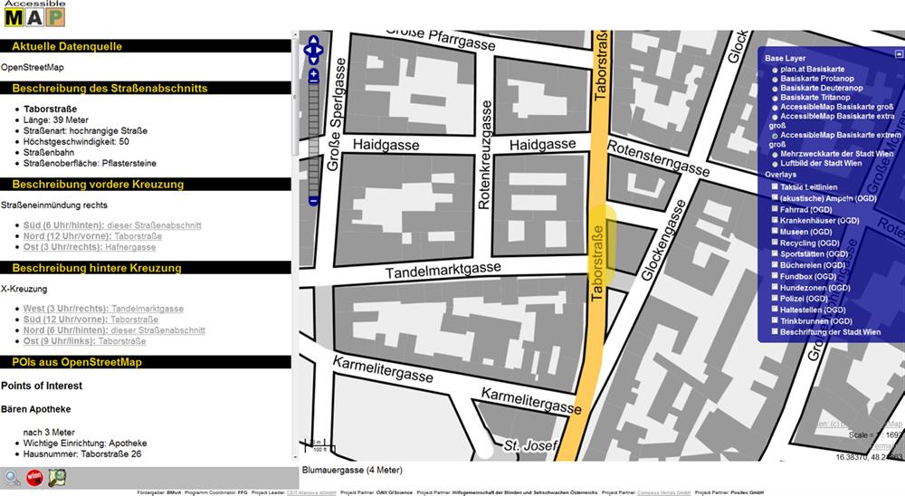
A prototype of the 'talking city map' for Vienna has been launched. The spoken description of the map gives an idea of what a street looks like, how long it is, and what infrastructure, shops, and parks are nearby. The tool can be used to prepare for an upcoming trip or, via the mobile application, to get detailed information about one's surroundings while walking through the city. Currently the spoken voice is only available in German but it is planned to implement more languages at a later stage.
Problems Targeted
Until now, maps and city maps available on the internet were not accessible to persons with visual impairments. To enable the independent usage of online and mobile city maps and to convey an idea of one's surroundings or current location, this online and mobile application was developed.
Solution, Innovation and Impact
Online maps made accessible
Media
Pictures
Related information
- Connections
- 2
-
Organization
- People